Troubled Geographies:
Two centuries of Religious Division in Ireland
|
Troubled Geographies:
|
|
Summary |
|||||||
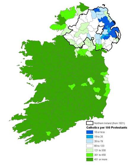
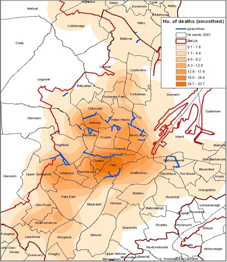
Religion has played a defining role in shaping Irish culture, society, identity and attitudes. Geography is essential to understanding religion in Ireland. As a marker of national identity it was used, for example, to delimit Northern Ireland when the island was partitioned. It has also underpinned many aspects of the recent ‘Troubles’ where the spatiality of conflict has been shaped by ‘sense of place’ and the geography of community background. Likewise, changing denominational distributions and numbers have been the subject of debate in the Republic of Ireland. It is therefore remarkable that despite the importance of religion, religious geographies over longer historical periods have been neglected. This project addresses this lacuna providing information on the geography of religion on the island of Ireland through the nineteenth and twentieth centuries. Researching religion and society requires a fusion of approaches from the humanities and the social sciences. Narratives about religion and society are combined, for example, with insights gained from quantitative spatial analysis using historical Geographical Information Systems (GIS). The objectives of the project are to explore the interactions between religion, demography, violence and identity in Ireland, to provide a data resource for scholarly use, and to develop an online interactive atlas for the wide public. Aims:
|
|||||||
|
|
|
|
|