3D surface and DEM construction from images
Digital elevation models (DEMs) have been made from images for many years. However, traditional photogrammetric analyis techniques require considerable expertise for both image capture and data processing. The recent emergence of structure-from-motion and multi-view stereo (SfM-MVS) approaches from the computer vision community offer the potential for significantly easing some of the requirements for obtaining 3D models from consumer cameras for geoscience applications.One of the main drawbacks of SfM-MVS is that the error assessments that are integral to photogrammetric workflows are difficult to carry out as they are not implemented in the SfM-MVS reconstruction pipelines. However, error magnitudes do appear suitable for many geoscience applications (James & Robson, 2012) with surface precisions being around 1:1000 (i.e. a precision of ±1 mm for every 1 m of viewing distance). Jim Chandler has also carried out some accuracy assessment of the output from Autodesk's SfM-MVS webservice, 123D Catch.
Most of the reconstructions carried out here have been done using the free 'Bundler Photogrammetry Package' put together by Josh Harle (requires 64-bit machine, Windows and Nvidia graphics card). The output is a dense point cloud representing the reconstructed surfaces, but does not have a scale and has an arbitrary orientation. To attribute scale or to fully georeference the model, see sfm_georef, which also gives for further example models.
Point clouds: To view the point clouds on the links given, you must have a browser that supports WebGL. Test yours here. Chrome and Firefox do (They may need configuring, this did it for me).
SfM software: A table of SfM software and websites is available here ![]() .
.
SfM Publications
Bemis, S. P., Micklethwaite, S., Turner, D., James, M. R., Akciz, S., Thiele, S. and Bangash, H.A. (2014) Ground-based and UAV-based photogrammetry: A multi-scale, high-resolution mapping tool for structural geology and paleoseismology, J. Structural Geology, 69, 163-178, doi:10.1016/j.jsg.2014.10.007
James, M. R. and Robson, S. (2014) DEM-sequences of active lava flows from ground-based image sequence processing, ISPRS J. Photogram. Remote Sens., 97, 160-170, doi:10.1016/j.isprsjprs.2014.08.011
James, M. R. & Robson, S. (2014) Mitigating systematic error in topographic models derived from UAV and ground-based image networks, Earth Surf. Proc. Landforms, 39, 1413–1420, doi:10.1002/esp.3609
Nouwakpo, S. K., James, M. R., Weltz, M. A. and Chagas, I. (2014) Evaluation of structure from motion for soil microtopography measurement, Photogram. Record , 147, 297-316, doi:10.1111/phor.12072
Castillo, C., Taguas, E. V., Zarco-Tejada, P., James M. R., Gómez, J. A. (2014) The normalized topographic method: an automated procedure for gully mapping using GIS, Earth Surf. Proc. Landforms, doi:10.1002/esp.3595
Tuffen, H., James, M. R., Castro, J. M. and Schipper, C. I. (2013) Exceptional mobility of an advancing rhyolitic obsidian flow at Cordón Caulle volcano in Chile, Nature Comms., 4, 2709, doi:10.1038/ncomms3709
James, M. R. and Quinton, J. (2013) Ultra-rapid topographic surveying for complex environments: The hand-held mobile laser scanner (HMLS), Earth Surf. Proc. Landforms, doi:10.1002/esp.3489
James, M. R. and Varley, N. (2012) Identification of structural controls in an active lava dome with high resolution DEMs: Volcán de Colima, Mexico, Geophys. Res. Letts., 39, L22303, 10.1029/2012GL054245
James, M. R., Applegarth, L. J. Pinkerton, H. (2012) Lava channel roofing, overflows, breaches and switching: insights from the 2008-2009 eruption of Mt. Etna, Bull. Volc., 1, 107-117, 10.1007/s00445-011-0513-9
Castillo, C., Pérez, R., James, M. R., Quinton, J. N., Taguas, E. V. and Gómez, J. A. (2012) Comparing the accuracy of several field methods for measuring gully erosion, Soil Sci. Soc. Am. J., 76, 1319-1332, 10.2136/sssaj2011.0390
James, M. R. and Robson, S. (2012) Straightforward reconstruction of 3D surfaces and topography with a camera: Accuracy and geoscience application, J. Geophys. Res., 117, F03017, 10.1029/2011JF002289
Niethammer U. , Rothmund S. , James M. R., Travelletti J. and Joswig, M. (2010) UAV-based remote sensing of landslides, Int. Arch. Photogram., Rem. Sens. Spatial Inf. Sci., Vol. XXXVIII, Part 5, Comm. V Symp., Newcastle upon Tyne, UK., ![]()
Lava flows

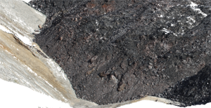
3D model of a section of the Puyehue-Cordón Caulle rhyolite lava flow (January, 2013). Advance of the dark lava is being hindered by the steep surrounding slopes.
Point cloud: low res (7 Mb)
Read more about this research in a BBC news report or see photographs of the 2013 trip.
Lava domes

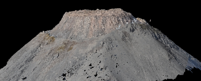
A reconstruction of Volcán de Colima's lava dome using SfM-MVS. Images collected by Nick Varley using a Nikon D90 dSLR from a light aircraft.
Point cloud: low res (7 Mb)
Soil erosion and gully formation

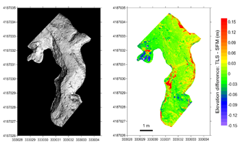
Study of an erosion gully near Cordoba, Spain. Left: Shaded relief DEM of the gully derived from the SfM-MVS point cloud. Right: Difference map between the SfM-MVS DEM and a similar DEM from laser scanner data. See a fly-through of the 3D reconstruction.
Carlos Castillo demonstrating a profilometer in the gully.
The topogaphic data acquired were compared with those from a laser scanner survey carried out at the same time. The SfM-MVS model was scaled and georeferenced using the MATLAB application sfm_georef. The results have been published as part of a study of the accuracy of field techniques used to measure gully erosion (Castillo et al., 2012).
Point cloud: low res (5 Mb)
Landslides

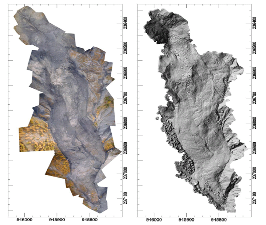
Left: Orthomosaic of the Super Sauze landslide. Right: Shaded relief representation of the DEM produced. From Niethammer et al. (2010)


