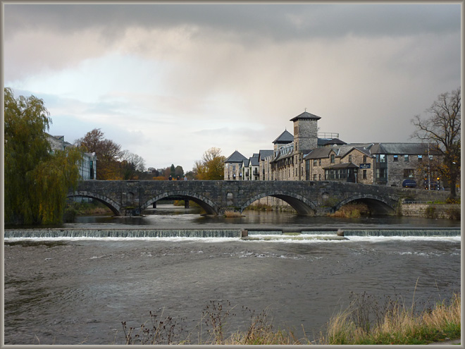

Kendal: Stramongate Bridge
Image © Meg Twycross 6 November 2010
The current bridge was built in 1794, but parts of the 17th-century bridge are incorporated into it. It is the second of the two main bridges of Kendal, carrying the main road north and east upstream of the town: ‘a handsome bridge, where three great roads coincide, from Sedbergh, Kirkby-Stephen, and Penrith’.1 It was also the bridge to the outlying district of Cross Bank. It was already there in the 14th century. Leland says in his Itinerary (c. 1535-43) that ‘Stramangate bridge’ is ‘of stone havynge 8 or 9 arches’. Celia Fiennes noted in 1698 that
The River Can which gives name to the town is pretty Large but full of Rocks and stones that makes shelves in the water, its stor’d with plenty of good fish and there are great ffalls of water partly naturall and added to by putting more stones in the manner of Wyers, at which they Catch Salmon when they Leape with speares. The Roaring of ye water at these place sometymes does foretell wet weather; they do observe when the water roares most in the fall on the Northside it will be ffaire, if on the Southside of the town it will be wet. Some of them are falls as high as a house.
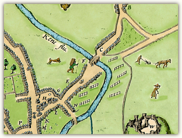
It appears on Speed’s 1611 map of Kendal (below) at F.

Detail of Town Plan of Kendal from the Westmorland map by John Speed
The Theatre of the Empire of Great Britaine (London: John Sudbury & George Humble, 1611-1612).
Image © Meg Twycross, based on a facsimile by and © Julie and John Higham,
Souvenir Antiques, Carlisle, with their kind permission.
There is still open land to the south east of the bridge. The tenter frames were used to stretch cloth. The downstream bridge in this part of the map is Miller Bridge, then made of wood and liable to be swept away when the river was in spate.
See more early maps of Kendal.
Return to Kendal image index or Next image
1. Thomas West A Guide to the Lakes (Kendal and London: William Pennington, 1778-1821). Quoted by Martin and Jean Norgate Old Cumbria Gazetteer: an invaluable resource. Return