We’re very pleased to have been awarded a Pelagios Commons Resource Development Grant to explore the annotation of a series of historic maps using Recogito. Our corpus of maps includes those produced in the sixteenth-century for the Relaciones Geográficas de Nueva España across the area which is currently Mexico.
On Monday 17th June, in collaboration with our colleagues in the LLILAS Benson Latin American Studies and Collections at The University of Texas at Austin, the National School of Anthropology and History (ENAH), The National Autonomous University of Mexico (UNAM), the National Institute of Anthropology and History (INAH), and the University of Lisbon, we will be delivering an online workshop which will deliver training on Recogito for the annotation of the sixteenth-century maps of the Relaciones Geográficas.
We will be working with 27 scholars from UNAM and ENAH, delivering training on Recogito, and presenting an introduction to the Spatial Humanities and the use of these technologies. From here, this will evolve into a citizen science project, where we will meet online every week to take part in ‘mappathons’ with all our participants, completing the annotation of our full corpus of sixteenth-century maps.

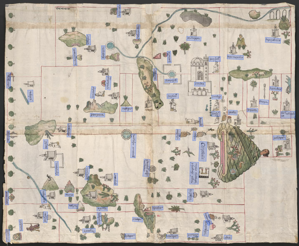
‘The map of Cempoala’
Relaciones Geográficas de México y Guatemala, 1577-1585. Joaquín García Icazbalceta Manuscript Collection, University of Texas.
We will be annotating the full corpus of the Joaquín García Icazbalceta Collection of Relaciones Geográficas of Mexico and Guatemala (University of Texas at Austin), as well as a number of maps from the Archivo General de Indias and the Archivo General de la Nación. These maps are a unique reflection on sixteenth-century settlements in Mexico, drawn using a combination of indigenous and European techniques and ideas. This interplay of indigenous and European voices is a key part of these maps’ significance, offering a unique insight into multiple perceptions of space and place during this crucial period in Mexico’s history. The maps of the RGs contain a great variety of information, both textual and pictographic, which offer invaluable insight into the historical and geographical contexts in which these maps were produced. This information includes proper names in the form of both traditions, logographic Mesoamerican toponyms and people’s names and European alphabetic glosses.
Glyphs and Glosses
Digitally annotating these maps using Recogito gives us a promising opportunity to analyse this corpus, which is not heavily text-based, but features text alongside pictographic depictions of space and place. Annotating both logographic toponyms and alphabetic descriptions and place-names will enable us to better understand the different ways in which Mesoamerican indigenous spatial knowledge and portrayals changed over time, and the processes through which these became ‘subaltern’ to European thinking.

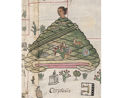
Close-up view of a toponym glyph and alphabetic gloss for Cempoala
‘The map of Cempoala’. Relaciones Geográficas de México y Guatemala, 1577-1585. Joaquín García Icazbalceta Manuscript Collection, University of Texas.

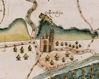
Close-up view of a logographic depiction of the ‘Cerro de tigre’ with alphabetic gloss
‘The map of Teguantepec’. Relaciones Geográficas de México y Guatemala, 1577-1585. Joaquín García Icazbalceta Manuscript Collection, University of Texas.

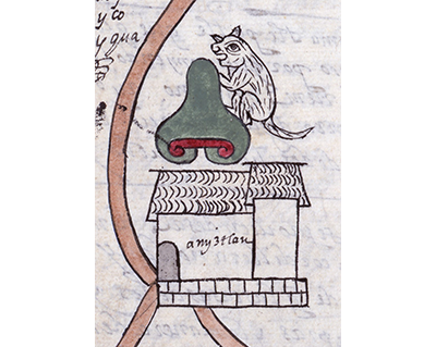
Close-up view of a toponym glyph and alphabetic gloss for Amiztlan
‘The map of Jojupango’. Relaciones Geográficas de México y Guatemala, 1577-1585. Joaquín García Icazbalceta Manuscript Collection, University of Texas.
You can read the Pelagios Commons announcement here to read more about their Small Grant Awards and other awardees!


