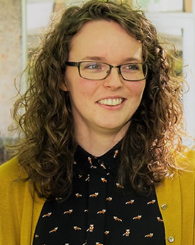
Professor Ian Gregory
Distinguished Professor of Digital HumanitiesCurrent Teaching
- Hist426 - Digital approaches to the Humanities
- FASS525 - Geographical Information Systems in the Humanities and Social Sciences
Additional Information
I co-founded and co-direct Lancaster's Digital Humanities Centre.
Research Overview
I work in Digital Humanities and am particularly interested in using Geographical Information Systems (GIS) with texts as well as the more traditional quantitative sources. I have used these approaches to study a range of topics from historical demography to Lake District literature. This research has been the subject of a number of major projects including the European Research Council funded Spatial Humanities: Texts, GIS, Places, the Leverhulme Trust funded Geospatial Innovation in the Digital Humanities and, most recently, the ESRC/NSF Funded Space Time Narratives project. For much more on my research see my personal website.
PhD Supervision Interests
I would be interested in supervising any PhD student who wants to do a PhD that uses Digital Humanities, Historical GIS or Spatial Humanities in any way. One area of particular interest is that at Lancaster we are very lucky to have access to the underlying data that make up some very large digital collections. This means that PhD students will be able to conduct research that uses these sources in, for example, corpus linguistics, GIS or statistical software, without the limitations imposed by public web interfaces. These include large textual corpora such as: Early English Books Online (http://www.textcreationpartnership.org/tcp-eebo); the Histpop collection of population reports for Britain and Ireland, 1801-1937 (http://www.histpop.org); the British Library's Nineteenth Century Newspapers Collection (http://www.history.ac.uk/reviews/review/730); and a major corpus of Lake District writing (http://www.lancaster.ac.uk/fass/projects/spatialhum.wordpress/?page_id=43). If required, we can geo-reference these such that they can be analysed using geographical information systems (GIS). We also have access to several major quantitative databases including: the Integrated Census Micro-data (ICeM) data of individual-level census data from 1851-1911 (http://www.essex.ac.uk/history/research/icem); aggregate data from the Great Britain Historical GIS covering much of the 19th and 20th centuries (http://www.gbhgis.org); and similar resources for Ireland. Again, this material can be incorporated into GIS. Additional permissions may be required to use some sources, however we would be very interested in hearing from anyone who is developing a PhD that uses any of these, with or without GIS. Training in software and methods including corpus linguistics, GIS and databases can be provided. What we are really interested in project ideas that either conduct applied research or develop methodologies that exploit the vast amounts of historical information in these sources. Do feel free to contact me informally if you would like to discuss anything.
Selected Publications
Comparisons between the geographies of mortality and deprivation from the 1900s to 2001: spatial analysis of census and mortality statistics
Gregory, I.N. 11/09/2009 In: BMJ. 339, n/a, 8 p.
Journal article
Mapping the English Lake District: a literary GIS.
Cooper, D., Gregory, I.N. 01/2011 In: Transactions of the Institute of British Geographers. 36, 1, p. 89-108. 20 p.
Journal article
Different Places, Different Stories: Infant Mortality Decline in England and Wales, 1851-1911.
Gregory, I. 2008 In: Annals of the Association of American Geographers. 98, 4, p. 773-794. 22 p.
Journal article
All Publications
Understanding imprecise space and time in narratives through qualitative representations, reasoning, and visualisation
01/04/2022 → 30/06/2026
Research
Envisaging Landscapes and Naming Places: the Lake District before the Map
01/05/2021 → 30/11/2022
Research
Revealing Long-Term Change in Vegetation Landscapes: The English Lake District and Beyond
01/11/2019 → 30/09/2022
Research
Digging into Early Colonial Mexico: A Big Data approach to XVI century historical
31/12/2017 → 31/12/2020
Research
Geospatial Innovations in the Digital Humanities: A Deep Map of the English Lake District
19/10/2015 → 19/10/2018
Other
ESRC centre for Corpus Approaches to Social Science - CASS
31/03/2013 → 30/03/2018
Research
FP7: Spatial Humanities
01/01/2012 → 31/12/2016
Research
Corpus Research in Early Modern English
01/10/2011 → …
Research
The presbyterian Church in Ireland 1871 - 2001
01/03/2010 → 28/02/2011
Research
Troubled Geographies: Two centuries of religious division in Ireland
01/11/2007 → 31/10/2009
Research
Spatial Humanities: Finding spatial and time narratives in corpus data
Participation in workshop, seminar, course
Launch of Digital Humanities Centre, Lancaster University
Other
The influence of the Ordnance Survey on the Lake District’s namescape
Invited talk
Travels and Tours in Cumbria before the Discovery of the Lakes
Public Lecture/ Debate/Seminar
Campus in the City, 2018
Other
Young Academy of Europe (External organisation)
Member of an organisation
British Library Labs Award, Research
Prize (including medals and awards)
- DSI - Society


